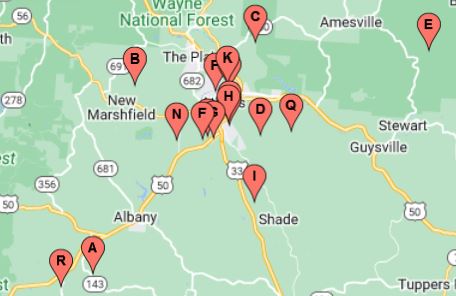
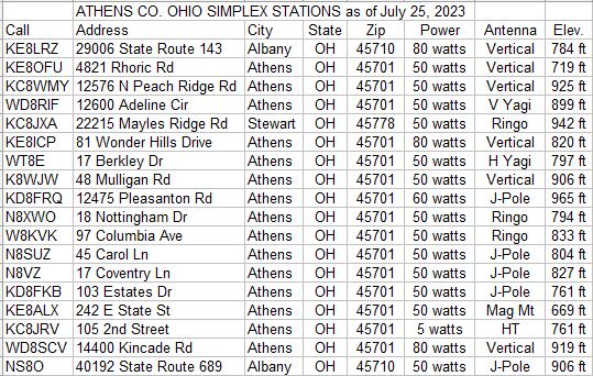
Athens County OH VHF Simplex Net Stations

Click static image above for full interactive map. 'Hover' icons for
Callsign and QTH.
'Click' icons for power, antenna, and ground elevation AMSL.
Map also available in
KML format for Google Earth terrain analysis, etc.
